Publications
 Partners


Reforestation is a common feature in climate change plans, aimed at capturing carbon from the atmosphere. But there is another, overlooked type of natural carbon sink – peatlands, writes Mauro Lourenco.
- For climate change news and analysis, go to News24 Climate Future.
Ask most people what they picture when thinking about natural "carbon sinks" – ecosystems that absorb and store greenhouse gases – and they'll probably describe a forest. Reforestation is a common feature of climate change plans.
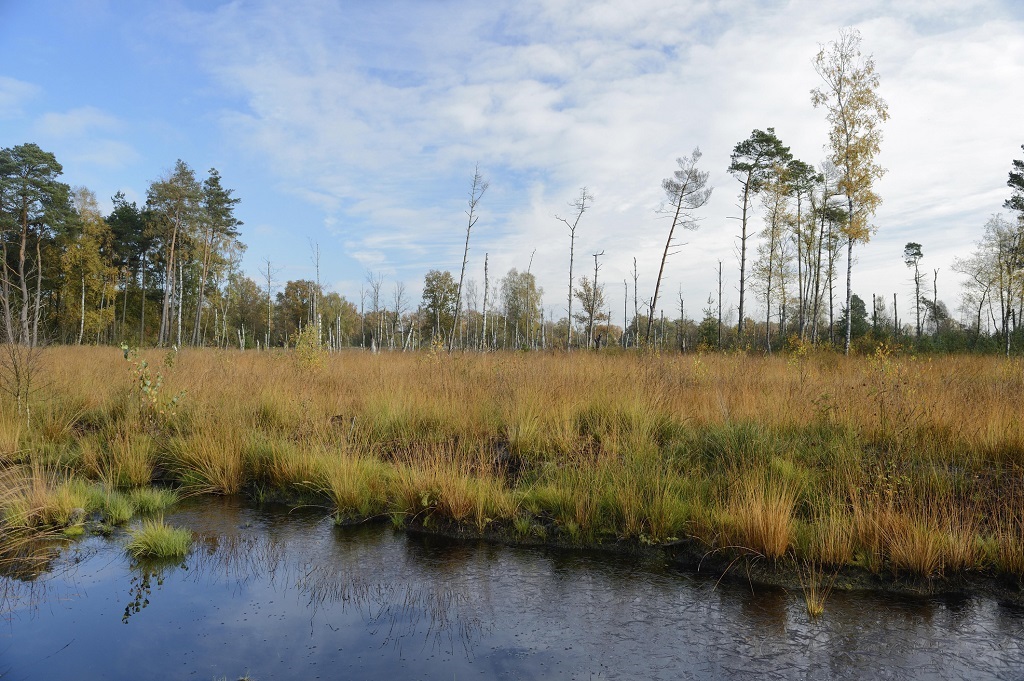
But there's another equally important, often overlooked type of natural carbon sink: peatlands. These are a particular type of wetland ecosystem in which dark, loamy peat soil is produced. Peatlands store more carbon than all the world's forests combined.
And they do more than store carbon. They conserve biodiversity, purify water and reduce flooding and soil erosion. They also play an important role in agriculture – they're good for planting certain crops, such as potatoes and carrots.
Despite this, even global scientific bodies have not paid much attention to peatlands until very recently. Global maps and inventories of peatlands are inconsistent, though there is more data for the northern hemisphere compared to the southern hemisphere and the tropics. High quality peatland extent data are only available for a small selection of countries and regions, including Canada, Sweden and West Siberia.
This gap needs to be filled urgently: discovering, quantifying and protecting new peatland deposits is necessary in an uncertain climate future that depends on intact, natural carbon sinks.
That's why, for my PhD, I set out to quantify and map recently discovered peatland deposits in the drastically understudied Angolan Highlands. This region is hydrologically and ecologically important. One of the reasons is that it's the primary source of water flowing into the Okavango Delta, a UNESCO world heritage site, in north-west Botswana.
The Okavango is a flat, extensive and seasonally flooded alluvial fan that is one of very few large inland delta systems that do not drain into the ocean. Instead, it drains into the desert sands of the Kalahari Basin.
READ | How debt-for-nature swaps are resuscitating climate action investments in Africa
I worked alongside my PhD supervisors, Professor Jennifer Fitchett and Professor Stephan Woodborne, using remote sensing to estimate that there are about 1 634 km² – that's approximately 230 000 full-sized soccer fields – of peatland in the Angolan Highlands.
It's a conservative figure, since the mapped area spans just 16% of the Angolan Highlands and 4% of Angola. For comparison, the largest tropical (and African) peatland deposit, which was also recently mapped in the Democratic Republic of the Congo in the Congo Basin, spans 145 000 km².
This is the first estimate of peatland coverage in Angola. And the study reveals potentially more tropical peatland deposits to discover in the highlands region and surrounding river basins.
Remote mapping
In 2015 the National Geographic Okavango Wilderness Project was launched to create a network of newly protected areas to conserve the length of the Okavango Catchment. It has been surveying and collecting scientific data on the river system and working with local communities; NGOs; and the governments of Angola, Namibia, and Botswana to secure permanent, sustainable protection for the greater Okavango Watershed.
The Okavango Delta is dependent on precipitation occurring in the highlands of central Angola, where water flows south into the Okavango River from two tributaries: the Cuito River and Cubango River. The greater Okavango Catchment encompassing these three rivers covers approximately 112 000 km² and spans three countries – Angola, Namibia, and Botswana.
The source waters originate from areas which experienced historical conflicts and wars, and remain unprotected by legislation. The National Geographic Okavango Wilderness Project was created because of concerns about threats to the Angolan region of the Okavango catchment, and the potential downstream consequences to the Okavango Delta.
During groundbreaking scientific explorations, the project team identified extensive peatland deposits in the Angolan Highlands. These were the first known scientific explorations of these rivers and source lakes; new plant and animal species were discovered. The peatland identification was also a first. In June 2022, I was invited to be a member of the research team on the Lungu Bungu River expedition in Angola.

The author at work (after Covid lockdowns) extracting peat soil on the Lungu Bungu river transect. Jen Guyton
For my PhD, which I started in January 2020, I planned to conduct extensive fieldwork in the Angolan Highlands to quantify the newly discovered peatlands. But by April 2020, the world was largely locked down by the Covid-19 pandemic. It looked like I had no chance of getting to my study site.
Then I was introduced to Google Earth Engine, a powerful cloud computing platform for earth observation, science and analysis, and discovered I could collect an incredible amount of geospatial data about my study site from home.
Peatlands have unique characteristics that distinguish them from terra firma. Geospatial scientists use multisensory approaches. Optical, radar and LiDAR satellite imagery are all employed to identify and distinguish peatland from other wetland features.
READ | Earth's inner core may have started spinning the other way - scientists
Peatlands have also been mapped according to their geophysical properties, including vegetation cover, topography, and the presence of standing water. I drew these categories of data for the Angola Highlands from Google Earth Engine. Then I worked through them iteratively over a number of Zoom calls with my supervisors.
All this data was overlaid and Google Earth Engine's machine-learning algorithms were used to produce the first classification map of peatlands in the Angolan Highlands.
Valuable information
Angola, like many other African countries, is highly vulnerable to climate change. Preserving these important peatland deposits will help facilitate carbon capture. This will allow nature to reduce greenhouse gas concentrations in the atmosphere for free.
The identification and mapping of these peatland deposits will also help to facilitate preservation of the Angolan Highlands region. The health and ecological functioning of these peatlands has direct implications for local communities who rely on the peatlands for water purification, fishing, cultivation and fuel.![]()
Mauro Lourenco, PhD student, University of the Witwatersrand
This article is republished from The Conversation under a Creative Commons license. Read the original article.
The views of columnists published on News24 are therefore their own and do not necessarily represent the views of News24.