Publications
 Partners


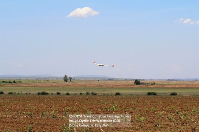
The CSIR and the Agricultural Research Council worked with emerging farmers to collect data from unmanned aerial vehicles (UAVs) during the 2019/20 and 2020/21 growing seasons to demonstrate the usefulness of such data and refine the precision farming methods.
This forms part of efforts by the CSIR and stakeholders in agriculture to develop a precision agriculture information system. The goal is to enable better cost optimisation and better surveillance of pest and diseases and yield prediction. For example, the CSIR has partnered with FarmSol Holdings, an Agricultural services company and SA Breweries partner, to digitally transform their maize production extension services via drone and satellite technologies and big data analytics.
UAVs are powered, re-usable automatic aircraft. They offer cost-effective means of bringing near real-time actionable information to support precision agriculture. Using drone imaging technology, farmers can timely detect and observe changes in crop condition or stress, thus enabling timely decision making to improve yield and quality of farm produce.
The solutions under development are needed by emerging farmers whose productivity is affected by changes in the environment, requiring them to take decisions on challenges such as crop health and growth, plant density and crop damage.
This post and content is sponsored, written and provided by CSIR.